Map the Arrow Thickness and Arrow Color dimension elements and metrics.
Tap the  button at the top right corner.
In the Map dialog box that opens enable the Arrows switch button:
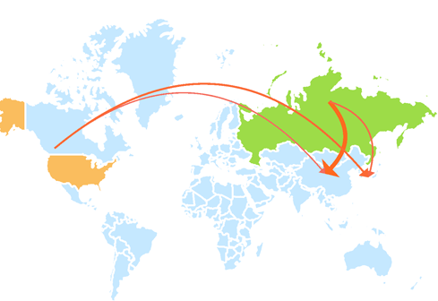
An arrow is a map object linked to two territories: the one where the arrow starts and the one where the arrow is directed. Arrows enable the user to visualize direction of moving of any streams between territories, for example, export or import of goods.
Arrow size and color are used to show data.
Arrows are shown on meeting of data source requirements that is, a report must contain two territory dimensions.
To display arrows:
Map the Arrow Thickness and Arrow Color dimension elements and metrics.
Tap the  button at the top right corner.
In the Map dialog box that opens enable the Arrows switch button:

To hide arrows, disable the Arrows switch button or deselect elements by the Arrow Thickness and Arrow Color metrics.
The example of displaying arrows:

See also: