Geolocation marker is a point bound to territory. Markers enable the user to display items on the map that are required for a user, for example, shops or metro stations.
On hovering the mouse over the marker the user can set up showing of the tooltip containing various information about the point, to which it is linked (for example, the company name).
To show markers all requirements given in the Requirements for Showing Geolocation Markers section must be met.
NOTE. Showing geolocation markers is not available in the Time Series Analysis tool.
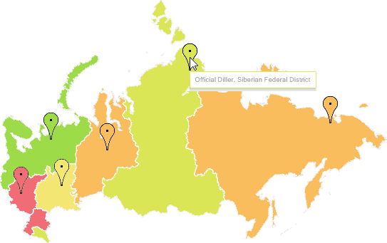
Example of the map with configured geolocation markers:
To set up:
Marker tooltips, use the Tooltips side panel tab. All settings of marker tooltips are the same as settings of map tooltips.
Marker fill, use the Markers side panel tab. All settings of marker fill are the same as settings of map fill.
Marker fill legend, use the Marker Legend side panel tab.
See also:
Map Advanced Features | Requirements for Showing Geolocation Markers