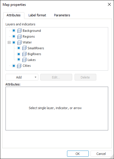
Factors are used to display information on a map. To set up indicators, use the Attributes tab in the Map Properties dialog box.

Determine the following settings:
Layers and Indicators. The list of all map layers is displayed. An indicator or arrow can be added for each layer. By default, all layers and added arrows and indicators are displayed on the map. To hide the layer, arrow or indicator, deselect the checkbox that corresponds to the object. When selecting or deselecting checkbox for a parent element, checkboxes for child elements are also selected or deselected.
Attributes. Attributes are displayed for the selected layer, indicator or arrow. The set of attributes depends on the selected element. The following attributes can be set up:
The attribute values are displayed as hyperlinks.
To edit the attribute value, click the hyperlink with the main mouse button. The attribute value is changed to the opposite one (yes or no), or the lower part of the Map Properties dialog box displays the boxes that are used to enter attribute value.
If the + sign is shown at the left of the attribute name, this attribute has a list of nested attributes that opens on clicking this sign.
See also: