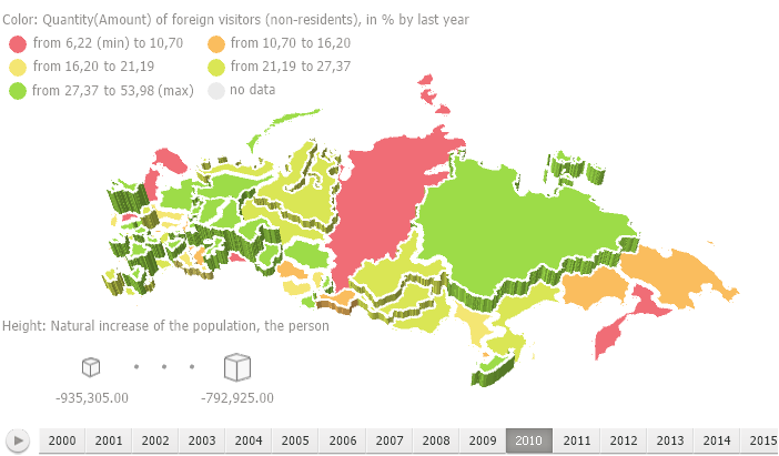
A map is used in various tools of Foresight Analytics Platform: Analytical Queries (OLAP), Reports, Time Series Analysis, Dashboards.

Key features:
Connect external map services.
Data drill down and drill up.
Use geolocation markers, arrows, pie and bar charts.
Set up tooltips, legend.
3D map mode.
Set up map style and display territory borders.
For details see the sections: Getting Started, Setting Up Dimensions for Working with Map, Setting Up Map, Map Advanced Features.
NOTE. Before starting the work with map, make sure that topobase is loaded to repository and main requirements are met to work with a map.
In the web application as in the desktop application, it is available to work with map. In the mobile application which implemented basing on the Foresight Mobile Platform, the map is read-only. Depending on the application in use there are the following differences in map functionality:
| Functionality | Desktop application | Web application | Mobile application |
| Executing operations with topobase |  |
 |
 |
| Displaying 3D map as globe |  |
 |
 |
| Setting up map layer |  |
 |
 |
| Data drill down and drill up. |  |
 |
 |
| Excluding and including map areas |  |
 |
 |
| Connecting external map services |  |
 |
 |
NOTE. The table contains only the functionality that is different depending on application version. The same functionality is not presented.
Designations:
 - functionality is fully available.
 - functionality is not available.
 - functionality is available with features of use.
See also: