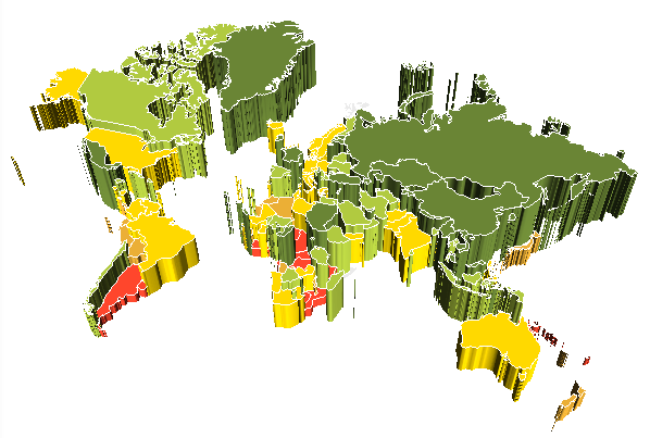
The 3D Map component is used to display map area data in 3D mode. The 3D map is used to display map data on mobile devices running iOS and Android version 2.2 or later.
Example of component appearance:

3D map enables the user to display two-value sets:
The first value is colour filling of a territory.
The second value is a territory height.
Main functions of the component:
Display various maps.
Display and set up map title, territory labels, tooltips, map legend.
Color scale setup: automatic breakdown of the scale into intervals by data source.
Region borders and other map elements display setup (line width, stroke and color).
Data visualization by means of: map, bar or pie factors, arrows, icons. On using factors, data is displayed by means of territory fill color or a bar or pie charts at the territory center.
Support languages with right to left text direction.
Use relative sizes of maps to fit in the parent container size.
Use animated timeline.
Automatically map redrawing when the window size of the mobile application is changed.
All files required to connect and use the component are included in the component. Execute the following operations to connect the component:
Connect MapCharting3d.framework or component source codes.
Connect QuartzCore.framework.
Connect MapKit.framework.
From the nushared-prognoz folder, add to the project:
All files in the NSString+ProperAlign folder.
All files in the SingletonPool folder.
All files in the UIColor+hex folder.
From the prognozshared folder, add to the project:
All files in the brush folder.
All files in the scale folder.
All files in the chart folder.
From the prognozshared\UI folder add the ColorSelector.h and ColorSelector.m files to the project.
See also: